
End-to-End Power Line Inspection Using UAV LiDAR
Watch the full webinar and explore a complete real-world workflow for UAV LiDAR inspection of transmission lines — from hardware setup and data acquisition to processing and final analysis.
Webinar Overview
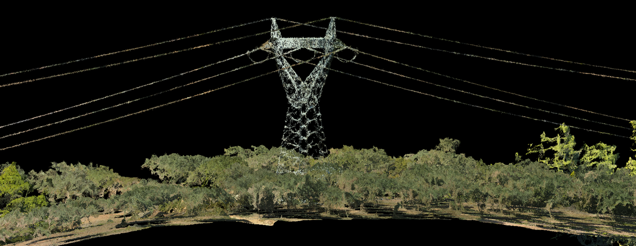
In this webinar, we walk through the complete UAV LiDAR workflow for power line inspection, starting with the GreenValley hardware used to capture transmission line data.
You will then see how raw data from the LiDAR instrument is transformed through pre-processing software into a georeferenced colorized point cloud, ready for analysis.
The session continues with a detailed walkthrough of LiPowerline and its capabilities for power line inspection, including classification, vectorization, segmentation, danger point detection, and clearance analysis against vegetation, ground, and nearby structures.
We also explore how the software generates priority reports for operators, helping inspection teams understand what actions are required and when.
A key part of the workflow is vegetation growth and tree fall simulation, which allows teams to estimate how close trees may be to transmission lines by the next fire season and plan preventive actions accordingly.
The webinar concludes with a real case study from Greece, showing how this workflow was applied in practice for 2,000 kilometres power line inspection.